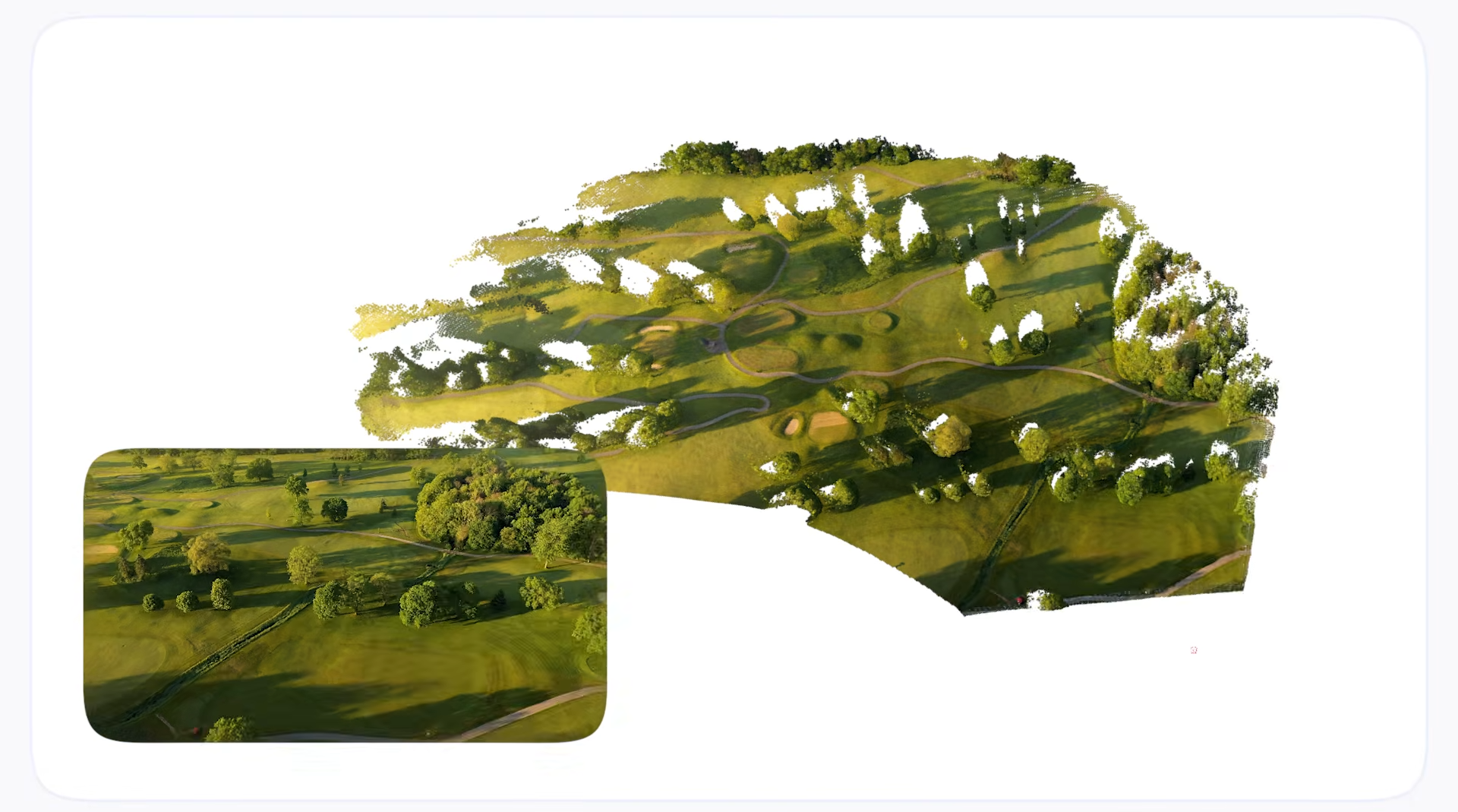
Smart cities run on three layers: sensors, connectivity, and AI-driven processing. The truth is that AI already works in traffic management, mostly public safety, and citizen services, but we want to address infrastructure monitoring and tracking roads, signs, and streetlights conditions; activities that remain still largely manual.
This article covers how we can use AI differently. How can we turn one car into a monitoring network? Camera-equipped vehicles turn existing fleets into your city's monitoring system. We will also cover the tradeoffs between edge, cloud, and hybrid processing, and a governance issue most vendors avoid: who actually owns the data a city collects. We’ll conclude with a checklist for evaluating any vendor selling this kind of system and two live projects in Montevideo and New York as reference points.
Introduction
City government budgets rarely grow as fast as the areas and needs it has to cover. Every year streets need repaving, signs fall over, lights burn out, containers overflow, and no matter how many people manage the streets, it isn’t enough. Most departments still find these problems the way they did thirty or fifty years ago: an inspector drives a route, or a resident calls in a complaint, which is not a scalable solution.
What Is a Smart City?
"Smart city" describes the alternative: collecting data across the city and running software that acts on it, so these systems need less guesswork and less manual labor. The idea has existed for over a decade. What changed recently is that the parts needed to make it work, cheap sensors, wide connectivity, and AI that can process images and signals in real time, became affordable and reliable enough to deploy at city scale.
This article is for those decision-makers who will see the value of adding innovative technology in their daily activities. We will cover what a smart city is actually made of, where AI does real work today, and what to ask a vendor before signing anything, including one question most vendors would rather you didn't ask: who owns the city data?
The Building Blocks
A smart city isn't a single product, and it isn’t built in a day or by a single person. It is a stack of layers that work together.
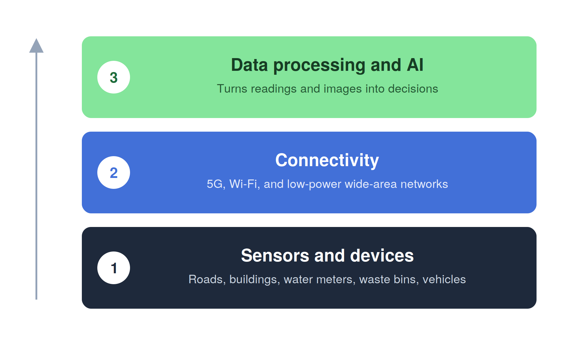
At the bottom, we can find sensors and devices embedded in roads, buildings, water meters, waste bins, and vehicles that measure a condition or capture an event as it happens. We will go through some examples below.
Now, on top of that sits connectivity. 5G, Wi-Fi, and low-power wide-area networks (LPWAN) move that data from the point of capture to wherever it gets processed, and this choice of network shapes what can be built on top of it. For example, an LPWAN can carry a small reading, like a water meter value, for years on one battery, but it cannot carry live video. The network decision can vary from case to case; you can decide which one you prefer according to the solution you want to build.
The third layer is data processing and AI. This is where readings and images become useful information for the city: a pattern in traffic camera footage becomes a change to a signal timing plan, an image of a cracked sidewalk becomes a work order. Without this layer, a city just accumulates data it never uses.
Where AI Earns Its Keep
A few areas account for most of the real deployments running today. Here are a couple of examples:
- Traffic and mobility systems watch camera and sensor feeds to adjust signal timing and detect incidents, which is a good alternative to running signals on a fixed schedule.
- Public safety systems that apply pattern recognition to camera networks can spot stalled vehicles on highways or unusual crowd density at events, for example, making it easier to prevent and oversee traffic jams.
- As for waste and utility systems, they can now use sensors in bins and pipes to report fill levels and leaks, so trucks and crews can go directly to the where the problem is, optimizing time and resources.
- Energy systems are also part of smart cities. They can forecast grid demand and manage distributed sources, like rooftop solar and EV charging, to balance supply without building new plants.
- Last but not least, infrastructure monitoring can use cameras and computer vision to inspect the physical condition of roads, signage, streetlights, and public assets.
The latter is where we are focusing at Digital Sense, and what we will highlight throughout the article. Citizen service systems route requests, potholes, missed pickups, and complaints to the right department without a person reading every ticket.
Traffic management and citizen services are the most established of these markets. Infrastructure monitoring from a moving vehicle, rather than a fixed sensor, is newer and less crowded, mainly because reliable computer vision on a moving car is a harder engineering problem than mounting a sensor on a lamppost.
Successful Smart City Projects: Those Already Running Solutions
- NoTraffic runs an AI-powered traffic signal platform active in cities like Phoenix, Houston, and Oklahoma City, adjusting intersections in real time rather than on a fixed schedule.
- Citilog's video analytics platform, installed on highways and in tunnels across Europe, spots stalled vehicles and wrong-way drivers from existing traffic cameras and alerts operators within seconds.
- RoadBotics, now part of Michelin Mobility Intelligence under its Better Roads product, mounts a smartphone on a city vehicle to score pavement condition across a road network, an approach it has run for Detroit's road network and for highway authorities in the UK.
- NRG Energy and Renew Home are building a gigawatt-scale virtual power plant in Texas, using AI from Google Cloud to coordinate smart thermostats and home batteries across roughly 200,000 houses during peak demand.
- Bigbelly's solar-powered waste bins report fill levels from more than 1,800 locations across 60 countries, cutting collection visits by 80% in some deployments.
The Gap in Infrastructure Monitoring
Roads, signs, streetlights, and public infrastructure can’t avoid the passage of time, they degrade from traffic, weather, and time and keeping a record of their condition matters for maintenance planning, yet most cities still do it manually, driving a route on a schedule, or waiting for a neighbor’s complaint. In both approaches you can find gaps; a scheduled inspection covers a street once every few months at best and a complaint-based system only catches what someone reports, which tends to reflect where residents are vocal, not where infrastructure is worst.
The thing is, sometimes the fix does not require new infrastructure or a monumental budget. It requires a camera and GPS on vehicles that already drive the city, patrol cars, waste trucks, inspection vans, running computer vision on the footage to detect and locate problems automatically.
Digital Sense built this system, first for the Intendencia de Montevideo and later for the New York City Department of Transportation, reaching detection accuracy above 94% for both traffic sign condition and streetlight outages.
From Footage to a Map
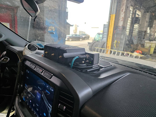
The solution for these departments wasn’t expensive or required years in planning and assistance. It required a camera and GPS module mounted on a vehicle that was already being used for city monitoring. The difference now is that, as it drives its normal route, the system captures video and location data in sync, then runs object detection models trained to spot the assets a city cares about: damaged or missing signs, potholes and pavement cracks, overflowing containers, streetlights that are off, unauthorized billboards, or graffiti.
The system doesn’t stop at the detection of the elements, but each carries a location, a timestamp, a confidence score, and a cropped image as evidence you can then pinpoint in a map. The information lands in a GIS layer or database the city already uses, so a maintenance team sees the entire city on a map, filters by asset type or severity, and dispatches crews based on current conditions instead of a fixed route.
The same pipeline has run against traffic signs, pavement condition, dumpsters, and unauthorized advertising, reusing the same computer vision approach with a different training set for each target. The write-up on AI-powered road defect and traffic sign recognition covers how that pipeline works end to end.
Edge, Cloud, or Hybrid
Where the AI actually runs affects cost and reliability more than almost any other choice in the system. As always, it depends on the type of solution you’re building.
When it comes to cloud processing, it sends video or images from the vehicle to a server for analysis. It keeps the hardware in the vehicle simple and cheap, and updating the model just means updating the server. The tradeoff is data. High-resolution dashcam video is expensive to transmit over mobile networks, and at fleet scale, running many vehicles for hours a day, that transmission bill grows fast. The thing about cloud processing is that it depends on a stable connection to work, which may not be what you are looking for.
As for edge processing, it runs the detection model directly on a computing unit inside the vehicle, often built on chips designed for on-device AI, such as Qualcomm's platforms (partners we are very proud to work with). In this case, the vehicle sends only the relevant detections, not the full video stream, which cuts data costs sharply and lets the system keep working with no connection, syncing results once one is available. Here, the tradeoff moves to hardware: the in-vehicle unit costs more upfront, and the model has to be optimized, often converted and quantized to run fast on limited hardware. The piece on deploying computer vision at the edge walks through this tradeoff using the NYC DOT deployment as the example.
To be honest, most deployments end up being hybrid, a combination of the two. This happens when data capture is made at the edge, and heavier processing that needs long-term storage is made in the cloud. This split keeps the recurring data cost low while keeping analysis flexible enough to add a new detection target without touching hardware already installed in the field.
For the setup, there is no correct answer. A small pilot in one neighborhood with good connectivity can run entirely on cloud processing, for example, and a large fleet, or one operating where connectivity is unreliable, gets better economics from the edge.
Ownership of The Data
Every camera-equipped vehicle produces two kinds of value: the immediate detections (this streetlight is out, this sign is missing, for example) and the raw footage and metadata used to generate that. The latter does not disappear once the report is made, it is what trains and improves the underlying models, which takes us to the topic of ownership: who owns the data the system generates. Well, the easy answer is that the client keeps it, meaning the one who is interested in creating the system, but it can get a little more complicated than that.
Some vendors write contracts in a way that raw data stays with them by default, regardless of who owns or leases the hardware. In practice, a city paying for a hardware lease and a monitoring service is also paying, through its own footage, for a dataset the vendor keeps and can reuse across other clients, including competing cities, without paying anything back for it. None of this is unusual or illegal, but a buyer should know exactly what is happening with the data before signing.
Now, not all cases are like that. The alternative is a contract where data ownership is stated plainly rather than assumed. A city can own its data outright at a higher service cost, or agree to let the vendor use it to improve shared models in exchange for a lower price. Either is a fair deal as long as both sides know which one they signed.
Here are the few points to settle beforehand: (a) who owns the raw video and images once collected, (b) where that data is stored and for how long, and (c) whether the contract separates the detections delivered as the service from the underlying training data.
How to Evaluate a Smart City Product
Here are the things you should consider when acquiring a solution like these, from our point of view:
- On the technical side, you should check, firstly, how accurate the model is on the city's actual conditions rather than a vendor's demo city, secondly, whether the system keeps working with no live connection or fails without one, and lastly, how long adding a new detection target takes once requested.
- For data and governance, the key aspects to focus on are data and ownership. This means a. who owns the raw footage and detections, whether the full dataset can be exported and the contract ended without losing history, and b. whether personal information, faces, license plates, gets filtered out or kept.
- Lastly, on the business side, we focus on pricing and maintenance. Check whether pricing is based on hardware ownership, a subscription, or a mix, how they change as the fleet grows. Then, check maintenance clauses and what does it include, meaning software fixes, hardware servicing, lens cleaning, sensor checks.
How to Start Building a Smart City
Rome wasn’t built in a day, but it had to start somewhere. Building a smart city does not necessarily require new infrastructure or huge budgets. Most cities already have vehicles that do monitoring: patrol cars, waste trucks, maintenance vans. These can become the sensor network, and as for the software that turns their footage into a live map of city conditions can start as a limited pilot on one route before scaling to a full fleet.
Digital Sense has run this path with two municipal transportation departments already, in Montevideo and New York City, and built the system to support edge, cloud, and hybrid deployment depending on a city's connectivity, fleet size, and budget. See the NYC DOT results or the Montevideo case study for detection accuracy from the project.
For more information about our solutions, check our success stories or contact our team for a custom consultation. Let’s start assessing your case.