Throughout this document, we will explore our Remote Sensing-Based Irrigation Management System, developed in conjunction with Digital Projex. The system's main objective is to provide farmers and technicians with a tool for analyzing water requirements and planning watering processes. This analysis and planning are based on FAO-56 recommendations, which are widely used as a key tool for irrigation planning.
The system uses daily climatological data obtained from ground stations. Satellite images are also extensively used to provide users with accurate and up-to-date information. The system is strongly based on geographic information, with a web-based geographical component that includes visualization of all the data produced by the system. Finally, a simulation component enables the user to test different irrigation strategies and decide which is the most suitable for the field's requirements.
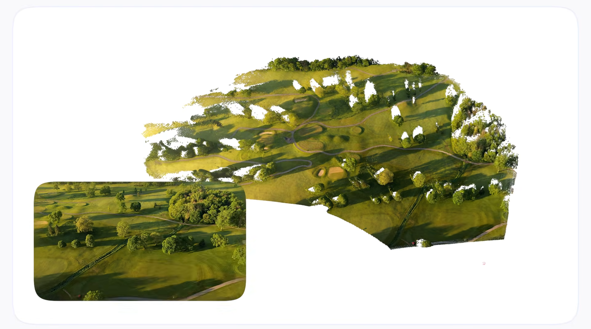
The system has been developed for “Regadores Unidos del Uruguay”, an association of extensive crop farmers that use irrigations in their systems. By the end of 2024, 20 different organizations had used it, covering an area of more than 25,000 Ha, nearly 20% of Uruguay's total irrigation area. The project was partially funded by Agencia Nacional de Desarrollo (ANDE), Uruguay.
Introduction
As the global population continues to rise, so does the demand for food and water, placing immense pressure on one of the planet's most critical resources: freshwater. Agriculture, the largest consumer of freshwater globally, uses nearly 70% of available water supplies, much of which is devoted to irrigation. Effective crop irrigation water management is vital for sustaining food production and preserving ecosystems, combating water scarcity, and mitigating the impacts of climate change. By optimizing how water is used in agriculture, we can ensure a balance between feeding the world and protecting the environment. This is a perfect example of what agritech solutions can tackle.

We have developed a remote sensing web-based system designed to monitor the water balance of each plot to be irrigated and project irrigation needs for the next seven days. It employs a methodology validated and published in Uruguay based on the FAO 56 guidelines (and explained in the next sections). The proposed system includes a soil water characterization module, an input module for crop agronomic variables, image processing and machine learning methods to compute some of the key parameters of the FAO 56 model, and the integration of climatic databases. Together, these components provide a weekly irrigation schedule based on rainfall data and satellite images and are completed with the local information from the irrigation activities. The system also incorporates a remote-sensing automatic estimation of reservoirs' available water, which is also crucial to the correct management of water resources.
Water balance: the model
The water balance model implemented is based on the well-known FAO 56 (also known as FAO - Penman-Monteith). This model, based on environmental, soil, crop, and management variables, indicates the water balance at each moment of the crop lifecycle. This day-by-day estimation is key for correct water management. This section presents a summary of the evapotranspiration process, as described in the document.
Evapotranspiration process
Given any vegetation (and in the particular case of our interest, crops), water is lost to the atmosphere by two different processes: a) evaporation of the water from the surface (usually the soil), and b) transpiration of the plant. Evapotranspiration (ET) is known as the combination of these two separate processes. Knowing the evapotranspiration each day is a key parameter for water management.
Evaporation
As mentioned before, evaporation is the process by which liquid water transforms into water vapor (vaporization) and is removed from the surface (vapor removal). Water evaporates from various surfaces such as lakes, rivers, roads, soils, and wet vegetation. Radiation, air temperature, atmospheric humidity, and wind speed are the climatic parameters to consider when evaluating the evaporation process.
Transpiration
Transpiration refers to the vaporization of liquid water contained in the plants, and its subsequent release into the atmosphere. Like direct evaporation, transpiration depends on the energy supply, vapor pressure gradient, and wind speed. Therefore, radiation, air temperature, atmospheric humidity, and wind must also be considered in its evaluation.
The soil's water content and its ability to conduct water to the roots also determine the transpiration rate, along with soil salinity and the salinity of irrigation water. The transpiration rate is further influenced by the crop's characteristics, the environment where it grows, and farming practices.
Evapotranspiration (ET)
Because evaporation and transpiration occur simultaneously, there is no simple way to distinguish between these two processes. Apart from the availability of water in the surface soil layers, the evaporation from cultivated soil is primarily determined by the fraction of solar radiation reaching the soil surface. This fraction decreases throughout the crop cycle as the crop canopy casts more and more shade over the soil. This means that the evapotransportation will be a function of time.
In the early stages of crop growth, water is mainly lost through direct soil evaporation. However, as the crop develops and eventually fully covers the soil, transpiration becomes the primary process. Figure 2 illustrates evapotranspiration divided into its two components (evaporation and transpiration) relative to the leaf area per unit of soil surface beneath it. At sowing, nearly 100% of ET occurs as evaporation, whereas when the vegetative cover is complete, more than 90% of ET occurs as transpiration.

ET Calculated Using Meteorological Data
Due to the difficulty of obtaining accurate field measurements, ET is commonly calculated using meteorological data. FAO-56 suggests two ways of estimating evapotranspiration, and both are based on a reference evapotranspiration coefficient known as ETo (explained later in this section):
- ETc is the crop evapotranspiration under standard conditions (disease-free, well-fertilized crops, grown in large fields, under optimum soil water conditions, and achieving full production under the given climatic conditions).
- ETc_adj is the evapotranspiration from crops grown under management and environmental conditions that differ from the standard conditions. In other words, in more realistic conditions.
In the case of crop evapotranspiration under standard conditions, ETc is determined using crop coefficients (Kc) that relate ETc to ETo, which is a reference evapotranspiration. Usually, Kc is separated in two different coefficients:
- Kcb, known as basal crop coefficient, and is mainly related to the crop transpiration process.
- Ke, known as the soil evaporation coefficient which obviously describes the evaporation component of the ETc.
In the case of cultivated surfaces under non-standard conditions, the evapotranspiration (known in this case as ETc_adj) is usually adjusted using a water stress coefficient (Ks).
This method integrates the FAO Penman-Monteith approach to estimate reference evapotranspiration (ETo) and adjusts for specific crop and soil conditions. The following diagram, based on [2], illustrates each one of these options:

The general formula is quite simple (although, as we will see, obtaining each coefficient is not an easy process):
\[ETc_{adj}: (Ks*Kcb+Ke)*ETo\]
The procedure for calculating crop evapotranspiration (ETc) involves the following steps:
- Obtain the Kcb coefficient:
- Identify crop development stages and select Kcb values: Determine the duration of the crop's growth stages and select the corresponding basal crop coefficient (Kcb) values.
- Adjust Kcb values for climatic conditions: Modify the selected Kcb values to reflect the climatic conditions specific to each crop stage.
- Construct the basal crop coefficient curve: Create a curve representing Kcb values over the growing season, allowing Kcb to be determined for any given period.
- Identify crop development stages and select Kcb values: Determine the duration of the crop's growth stages and select the corresponding basal crop coefficient (Kcb) values.
- Determine daily evaporation (Ke) values: Calculate the values of Ke to account for evaporation from the soil surface.
- Determine the daily Ks values.
- Calculate ETc: Combine the basal crop coefficient and evaporation coefficients to calculate ETc using the formula:
ETc_adj = ETo * (Ks * Kcb + Ke)
In the proposed system, we've selected the most complete model, which is the evapotranspiration under non-standard conditions:
ETc_adj = ETo * (Ks * Kcb + Ke)
Determination of the daily reference evapotranspiration ETo
The evapotranspiration rate from a reference surface, not short of water, is called the reference crop evapotranspiration or reference evapotranspiration and is denoted as ETo. The reference surface is a hypothetical grass reference crop with an assumed crop height of 0.12 m, a fixed surface resistance of 70 s m-1 and an albedo of 0.23. The reference surface closely resembles an extensive surface of green, well-watered grass of uniform height, actively growing and completely shading the ground. The fixed surface resistance of 70 s m-1 implies a moderately dry soil surface resulting from about a weekly irrigation frequency. ETo can be computed from meteorological data. The FAO Penman-Monteith method is recommended as the sole standard method for the definition and computation of the reference evapotranspiration. The FAO Penman-Monteith method requires radiation, air temperature, air humidity and wind speed data.
In most cases, as it is the case of Uruguay, ETo is given as part of the meteorological data provided by the different climate stations. More details about this and other climate data are presented in the “Determination of Climatological Variables” section.
Determination of daily crop transpiration coefficient Kcb
To approximate the basal crop coefficient (Kcb) curve, we only need three values: the initial date (Kcb_ini), the mid-season date (Kcb_mid), and the final date (Kcb_end). With these values, the crop coefficient curve can be constructed, and the Kcb coefficients can be determined. Below is an example of a generic crop:

Using this approach, determination of the Kcb is done by means of already computed tables for different crops: the process only requires adjusting the initial, mid and end dates.
Nevertheless, it is well known that this process can lead to wrong results. In particular, and depending on the environmental conditions, these dates may vary with respect to the predefined tables.
Several works have shown a strong relationship between Kcb factor and vegetation indexes obtained using satellite imaging. In particular in [1], authors applied regression models to obtain an equation that relates Kcb to NDVI, independently of the crop type:
Kcb = 1.44 * NDVI - 0.1
In our system, we've implemented this method using Sentinel-2 data to obtain the NDVI. A complete explanation of this approach is presented in the “Remote Sensing Kcb Estimation” section.
Determination of the Water Stress Coefficient Ks
The effects of soil water stress on crop evapotranspiration are described by the reduction of the crop basal coefficient by a factor Ks, known as the water stress coefficient. The Ks factor is modeled from the total water and the total available water. This is a very complex coefficient to compute, as it requires cumulative information of the water availability on the soil, which is a combination of rain and irrigation activities. Here again, the model requires the system to obtain precipitation data (see Determination of Climatological variables section) and the information about how much irrigation water was applied, which has to be provided by the user.
Determination of daily soil evaporation coefficient Ke
When the soil is wet, evaporation occurs at a maximum rate. However, the value of the crop coefficient (Kc=Ks*Kcb+Ke) cannot exceed a maximum value, Kc_max. This maximum is determined by the amount of energy available for the evaporation process at the soil surface. As the soil surface dries, less moisture becomes available for evaporation, and the evaporation rate begins to decrease according to the amount of remaining water in the top soil layer.
Ke = =MIN( Kr *(KCmax -Kcb), few *KCmax )*0.5
Kc_max is obtained from this equation:

Where in particular u2 is the wind speed at 2 m above ground surface, h is the mean altitude of the crop at the given analyzed period and RHmin is the daily minimum relative humidity. In this equation, u2 and RHmin can be obtained from climatological stations, as explained in section “Climatological variables”.
Water Balance: the system
The Crop Irrigation Management System is a Web-based Geographic Information System (GIS) that looks to combine agriculture and technology in an efficient way. The main functionality of the system is the possibility to register water availability, simulate irrigation and based on those simulations determine the water requirements for the next 7 days (this is an excellent example on how can AI help with the drought problem).
The user can create different irrigation projects and in each one of them, several fields can be defined for irrigation. The use also draws the region on which the irritation is applied:

The system is strongly based on FAO-56 recommendations. In order to apply FAO 56 model, the factors that relate the standard evapotranspiration ETo with the corresponding crop ETc are required: Ks, Kcb and Ke. Note that although ETo is also required, this variable is obtained directly from meteorological services. For instance, in the case of Uruguay, this is obtained through INIA website, which again follows FAO-56 methodology. The evapotranspiration ETc is obtained from these factors with the following formula:
ETc_adj = ETo * (Ks * Kcb + Ke)
In order to obtain each one of the three coefficients, the following information is required:
Water Stress Coefficient Ks: it requires:
- Climatological data (precipitation), which is obtained from climatological stations.
- Irrigation activities, which are entered by the user as it cannot be obtained automatically.
Crop Basal coefficient Kcb: it can be obtained from pre-computed crop tables. Each crop has its own Kcb table. The other possibility is to use remote sensing and infer Kcb from satellite images.
Evaporation coefficient Ke: again, this coefficient depends both on the crop characteristics and climatic conditions like wind speed, among others.
In summary, the system manages five sources of information:
- Pre-computed information: This is information that is configured once when the system is deployed. For instance, crop characteristics like Kcb values for each crop.
- Information entered by the user one or few times: characteristics of the irrigation system, equipment, geographical information of the fields where the irrigation system will be used, etc. Obviously, this information can be updated by the user when needed.
- Information entered by the user on a daily basis: The equation to obtain ETc requires daily information; some of this information needs to be entered by the user. For instance, the amount of water irrigated by day.
- Climatological variables: ETc also requires climatological variables that can be obtained from climatological stations. For instance: speed of the wind, max and min temperatures, the reference ETo, can be obtained automatically from these stations.
- Remote sensing data: Finally, the use of remote sensing data is crucial to have a much more detailed understanding of what is happening in the field. For instance, satellite images are used to compute the Kcb factor.
Water reservoirs
Because most of the water management is based on water reservoirs, having an automatic estimation of the available water is of utmost importance. The system incorporates remote sensing processes to determine the water area for each reservoir. In order to create a new reservoir, the user has to draw a bounding box around the reservoir, and enter the information about the water level, area and volume.

With this information, the system segments the reservoir area, and then uses the area and the values in the table to estimate the volume.
One difficulty to segment water using remote sensing data is that if it is only based on optical data, the information will not be available each time the region is covered by clouds (which in some places happens during several months). In order to avoid this problem and have an estimation on a regular basis, the system uses SAR images (in particular Sentinel-1). These type of images can sense the information on the ground even in the presence of clouds which makes them extremely useful for this specific problem.
In the following images we present the internal process that is executed to obtain the area. This process is not visible for the end user who only receives the estimated volume.
The process starts with the given polygon:

Using this polygon and the date, the system searches for the Sentinel-1 image closest to the specific date and retrieves it. This is an example on false color of the obtained image:

We can see that the water is clearly distinguished from the rest. A Satellite Water Index is then computed to obtain a better segmentation of the water:

And finally, a segmentation process is then executed to obtain a mask of the water, from which the area is computed to finally use the table to obtain the corresponding volume of water.
Remote Sensing Kcb estimation
As we have explained before, Kcb are obtained from a set of tables with fixed values for each crop. The problem with the fixed Kcb table is that it cannot take into account what is really happening in the field: weather conditions and other factors can impact on the days each crop enters the different phases. As mentioned before, several works have tried to understand if Kcb can be estimated using remote sensing data. In particular in [1], authors propose a simple linear correction to NDVI values:
Kcb = 1.44 * NDVI - 0.1
We have implemented this option (although using the Kcb based on tables is also available). In the following graphs we see the behaviour of the original Kcb and the one obtained from NDVI data. In the first one, we can see a strong correlation between both signals (red dots are discarded as they have high cloud probability). This is a case where the pre-computed Kcb fits correctly with what is happening in the field.

In this second image, we can see that the Kcb derived from NDVI has a different behaviour than the original Kcb. In this case, the installation of the crop takes more time than the theoretical one. If the Kcb used is higher than the real one (something that happens if we use the table-based Kcb instead of the NDVI-based one), the requirements of water will be underestimated, leading to very bad decisions (for instance, saying to the user that there is no need to irrigate).

Determination of Climatological variables
As mentioned before, climatological data is needed to accurately calculate the ETc. In particular, ETo is generally provided by national or local climatological stations. In our case, the system obtains the following data: Maximum Temperature, Minimum Temperature, Wind 2m/km/24hs, "Penman" Evapotranspiration mm:
- Tmax: Maximum air temperature in degrees Celsius.
- Tmin: Minimum air temperature in degrees Celsius.
- Viento_ms: Wind speed, measured at 2 meters height.
- ETo: "Penman" Evapotranspiration mm.
In the case of Uruguay, this information is obtained from INIA stations.
Information
Once all the information is uploaded to the system, the user can perform simulations, using different irrigation strategies. The user can also monitor the water requirements of the fields under irrigation. Several tools are provided to the user.
A first tool is a time-based graph, where the user can see water demands per day. The user can simulate different conditions and irrigation strategies to analyze the water demands on each case:

Available water
The user can also see information on the map. For instance, the user can see what is the percentage of available water on each field:


In this example, the field in the middle has its water requirements covered, the field on the right is entering a cycle with low available water and the field on the left is clearly lacking water. The colors help the user also to focus on the most important actions.
Irrigation recommendations
Water availability is not the only variable to look at: for instance, the crops on each field and when those crops were sowed also determine the water requirements. The user has another tool to see the irrigation recommendations based on the computation of the ETc:


In this case, the system is telling the user to program an irrigation for the left and right fields with 63 and 61 mm, while it is recommending not to irrigate the field in the middle.
Kcb Visualization
Finally, Kcb information is also relevant to the user because it is strongly correlated to how the crop is growing. The system shows the information but also shows the date in which the satellite image was captured, which is also relevant for the end user. Because satellites revisit periods of several days (5 days for Sentinel-2 constellation), it is important to know the exact day in which the image.


Conclusion
The implementation of a Remote Sensing-Based Irrigation Management System across more than 25,000 hectares marks a significant step forward in the adoption of data-driven agricultural practices. By integrating satellite imagery, meteorological data, and FAO-56-based modeling, this system supports farmers and technicians in making precise irrigation decisions, reducing water waste, and increasing crop productivity.
At Digital Sense, we have extensive experience in building tailored remote sensing solutions that transform complex data into actionable insights. In collaboration with public and private stakeholders—including the Ministry of Livestock, Agriculture and Fisheries (MGAP) in Uruguay—we have developed scalable tools that assist in water resource management, vegetation monitoring, and strategic agricultural planning. These efforts reflect our broader commitment to applying AI and satellite data to real-world environmental and operational challenges.
To explore how Digital Sense can support your remote sensing initiatives, visit our Remote Sensing Services page.
For further insights and case studies:
- MGAP Soil Erosion Monitoring Platform – A national-scale platform improving irrigation oversight through satellite and field data integration.
- Montes del Plata Forestry Irrigation – AI-powered remote sensing to reduce tree mortality and optimize irrigation cycles across large forested areas.
- Enhancing Satellite Data Quality with CESBIO – Improving Earth observation capabilities through advanced image processing.
- What is Remote Sensing? – A technical overview of how remote sensing is reshaping decision-making across industries.
References
[1] - Evaluation of Remote Sensing-Based Irrigation Water Accounting at River Basin District Management Scale - 2020, Jesús Garrido-Rubio et. al.
[2] - Allen, R.G., Pereira, L.S., Raes, D., & Smith, M. (1998). Crop evapotranspiration: Guidelines for computing crop water requirements. FAO Irrigation and Drainage Paper No. 56. [FAO, Rome].