.jpg)
What Is Sustainable Remote Sensing and Why It Matters Today
Sustainable Remote Sensing goes beyond simple geospatial data collection. It is defined as the strategic use of Earth observation technologies—including satellites, aerial sensors, and drones—to monitor and manage natural resources and the environment, ensuring that this activity is carried out in accordance with environmental responsibility, economic viability, and social equity.
The value we see in this is maximizing the benefits of satellite data and minimizing its negative impact. This is, we can do crop forecasting, deforestation detection, or water quality monitoring while promoting the use of smaller, more efficient satellite constellations or developing algorithms that optimize information processing.
Talking and focusing on sustainable Remote Sensing is key today for several fundamental reasons. According to the latest Intergovernmental Panel on Climate Change (IPCC) report, "Human activities, principally through emissions of greenhouse gases, have caused global warming, with global surface temperature reaching 1.1°C above 1850-1900 in 2011-2020". Thus, data-driven monitoring and strategic intervention are more critical than ever, enabling organizations to make informed, proactive decisions.
Take, as an example, the following scenarios:
- Global Change Monitoring: We are living in a climate crisis, so global change monitoring provides the capacity to objectively measure large-scale phenomena such as glacial melting, desertification, changes in ocean temperature, and changes in land cover. This information is essential for governments, businesses, and organizations to make evidence-based decisions.
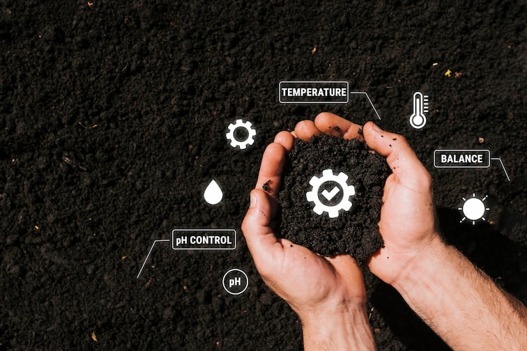
- Intelligent Resource Management: Because it is not realistic to simply stop production activities, humanity must find ways to continue producing raw materials, food, and energy while managing vital resources like water and land more efficiently and precisely. In other words, preservation of natural resources must be incorporated into these production activities. This ranges from optimizing irrigation in agriculture to detecting leaks in water infrastructure, maximizing productivity while conserving ecosystems.
- Tracking Sustainability Objectives: This means access to verifiable data on environmental variables, which facilitates accountability and paves the way to more sustainable practices.
The use of these techniques is making a real change for our future.
How remote sensing contributes to long-term ecological resilience
Ecological resilience means that the environment can change and adapt to new conditions while maintaining its function, structure, identity, and feedback. Sustainable Remote Sensing enhances this resilience by providing the continuous, objective data required for proactive management and intervention:
- Early Detection and Prevention of Disturbances: Remote sensing provides near real-time data, allowing for the rapid identification of subtle changes in vegetation health, water stress, or thermal anomalies. This translates to early warning systems for natural disasters (like wildfires or floods) or slow-onset phenomena (like pest infestations and soil degradation) before they lead to ecosystem collapse.
- Precision Conservation and Habitat Mapping: By offering high-resolution and multi-spectral imagery, remote sensing can accurately map critical habitats, migratory corridors, and biodiversity hotspots. This means targeting the most vulnerable areas and prioritizing them in the ensurance of long-term sustainability.
- Measuring Ecosystem Health and Recovery: Remote sensing tools quantify key ecological indicators, such as Net Primary Productivity (NPP), biomass, and forest canopy density. By tracking these variables over decades, scientists and managers can accurately assess the success of restoration projects (e.g., reforestation, wetland recovery) and monitor the rate at which ecosystems rebound after a major event.
- Informing Adaptive Governance: Long-term, consistent satellite records create robust historical baselines against which future changes can be measured. This data provides governments and organizations with the essential evidence needed to develop and enforce adaptive policies, land-use planning, and climate change mitigation strategies that safeguard ecological function for future generations.
If you are interested in new ways of using remote sensing technology for sustainable reasons, you can check our remote sensing services.
The Environmental Advantages of Sustainable Remote Sensing
The benefits are countless and they translate directly into measurable ecological improvements and mitigation of environmental risk. For example:
- Optimizing Water Use and Quality: High-resolution imagery and spectral data allow for precise monitoring of soil moisture, which enables smart irrigation that reduces water consumption in agriculture by only applying water where and when it is truly needed. At Digital Sense, for example, we've developed a Water Balance System that uses Remote Sensing Data for the efficient use of water for irrigation purposes. Furthermore, remote sensing detects pollutants, algal blooms, and sediment runoff in water bodies, providing immediate alerts to protect aquatic ecosystems and public health.
- Combating Deforestation and Promoting Reforestation: Satellites offer an unparalleled, large-scale, long timelapse and consistent method for monitoring forests. They are used to detect illegal logging activities in near real-time, providing authorities with the evidence they need to intervene fast. Just as well, these tools are essential for tracking the success and health of reforestation and afforestation projects.
- Enhancing Climate Change Mitigation and Carbon Sequestration: Remote sensing provides accurate, verifiable data on land use and land-use change, which is fundamental for quantifying carbon emissions and removals. It aids in identifying optimal areas for carbon sequestration (such as healthy forests and wetlands) and helps monitor compliance with carbon credit and climate agreements. At Digital Sense, we've worked with CESBio to propose new data processing algorithms for SMOS Satellite, whose main purpose (as its name indicates) is monitor the Soil Moisture and the Ocean Salinity. Ocean salinity is a key climate indicator because its patterns act as early signals of hydrological shifts, help constrain climate models, and are now observable globally via satellites such as SMOS.
- Sustainable Urban Planning and Infrastructure Monitoring: In urban environments, remote sensing maps critical environmental factors like heat islands, air quality, and green space distribution. This data supports the development of greener, more resilient cities because they guide decisions on where to bild and ensues construction activities adhere to environmental protection zones. In many cases, urban planning and infrastructure monitoring requires high resolution satellites such as WorldView or Pléiades. In this last case, we've worked with the French Space Agency to implement algorithms that improve the quality of the observed data.
- Protection of Biodiversity and Ecosystems: By providing detailed, current maps of terrestrial and marine habitats, remote sensing helps identify areas under threat from human activity or climate change. This enables targeted conservation actions, from creating protected areas to managing invasive species, ensuring the preservation of essential ecological services. This is the case of the National Crop Sustainability Monitoring System that Digital Sense has developed for the Uruguayan Government. With this system, the Uruguayan Government can promote good agronomical practices, have a good estimation of the country's crop production, and also enforce the application of the law whose main objective is to prevent erosion and preserve soil.
Key Technologies Powering Sustainable Remote Sensing
To make this a possibility, a synergy of advanced hardware, data collection techniques, and computational intelligence is necessary.
As an example:
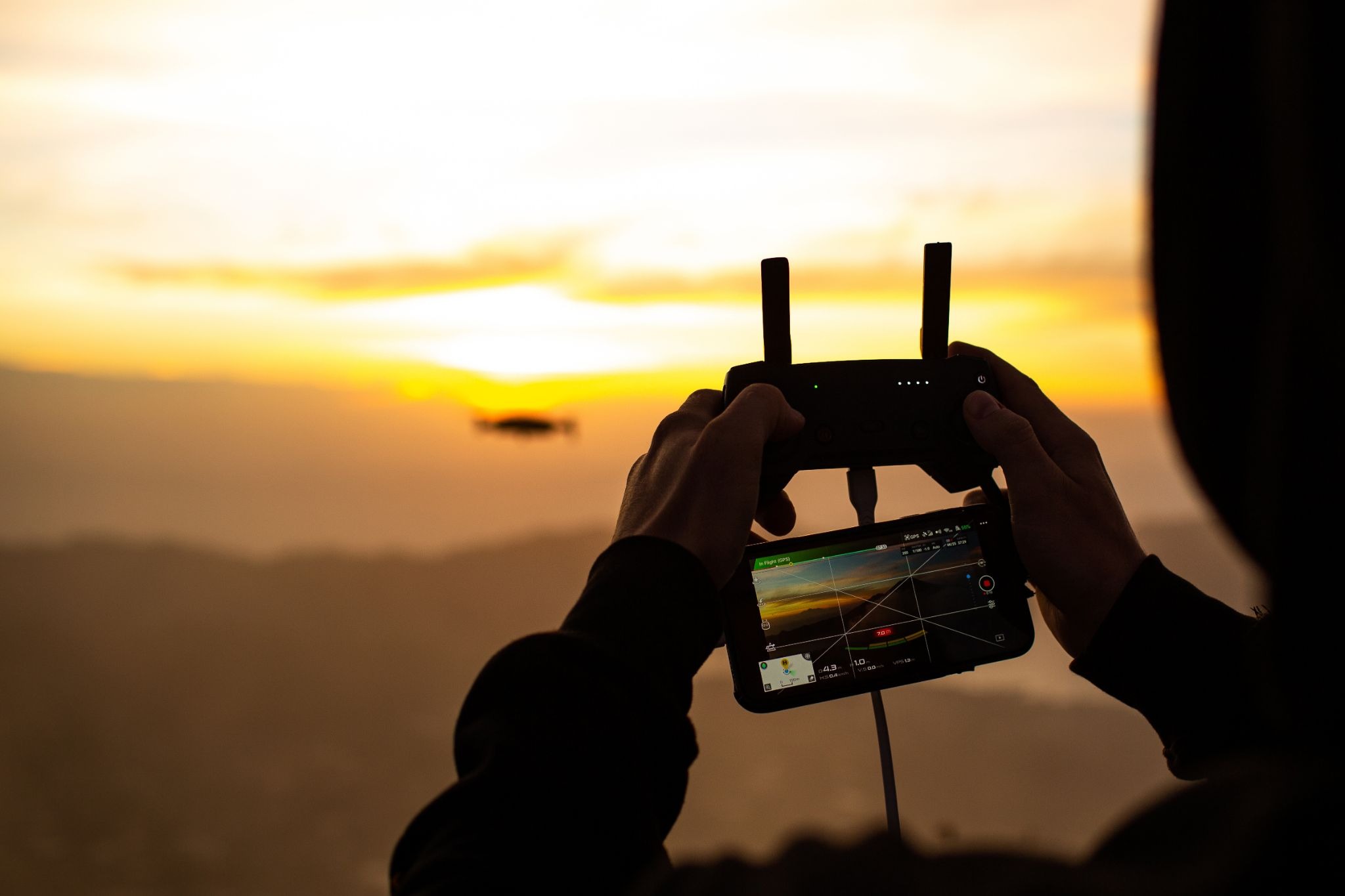
- Miniaturized Satellite Constellations (SmallSats and CubeSats): The shift toward smaller, more cost-effective satellites allows for the deployment of vast constellations. This increases the revisit rate (how often an area is imaged), providing high-frequency, near-daily data essential for real-time monitoring of dynamic environmental events like floods, wildfires, and rapid land-use change. Their reduced size also aligns with the sustainability principle of minimizing orbital space debris.
- Advanced Sensor Types:
- Multi-spectral and Hyperspectral Imagery: These sensors capture data across narrow bands of the electromagnetic spectrum, enabling the precise identification of material properties on Earth's surface. This is vital for analyzing crop health (via indices like NDVI), differentiating mineral compositions, and detecting water quality indicators (e.g., chlorophyll levels).
- Synthetic Aperture Radar (SAR): Unlike optical sensors, SAR actively transmits and receives microwave signals, allowing it to penetrate clouds and operate day or night. This is indispensable for monitoring land subsidence, measuring deforestation under persistent cloudy conditions, and tracking ocean oil spills.
- LiDAR (Light Detection and Ranging): This active remote sensing technology generates highly accurate 3D models of the Earth's surface and vegetation structure by emitting laser pulses. It is crucial for precise biomass estimation, calculating forest carbon stocks, and detailed topographic mapping.
- Cloud Computing and Geospatial Platforms: Processing the petabytes of remote sensing data generated daily requires scalable infrastructure. Cloud platforms provide the computational power for rapid data processing, storage, and dissemination. Geospatial platforms offer the standardized environments necessary for analysts worldwide to access, visualize, and collaboratively derive insights from this massive data volume.
- Artificial Intelligence and Machine Learning (AI/ML): This is the key to translating raw data into actionable intelligence. These algorithms are used for classifying land cover, identifying infrastructure, and detecting anomalies, for example, with high speed and accuracy.
Applications Across Industries
In many cases, the use of remote sensing and artificial intelligence not only improves the use of the natural environment but also reduces costs. In other words, the use of remote sensing and artificial intelligence applications is not only a way to comply with regulatory requirements but also to reduce costs.
The following highlights key applications across major sectors:
Agriculture and Precision Farming:
Remote sensing fundamentally changes how crops are managed, treating each crop differently. Satellite and drone data provide insights into soil health, nutrient deficiencies, pest pressure, and water stress and enables the precise treatment for each. This reduces costs, maximizes yields, and minimizes, for example, the environmental impact of fertilizers and pesticides.
At Digital Sense, we've developed several AgriTech systems with extensive use of remote sensing data:
Nation-wide Crop Management System to prevent soil erosion.
This system was implemented to address the challenges faced by the Uruguayan government in manually enforcing a national law that requires farms over 100 hectares to submit certified soil management plans for erosion prevention.
The solution is a satellite-based GIS that automates monitoring and compliance using Artificial Intelligence (AI), image processing, and satellite imagery. Its core functions include:
- Calculating slope gradients to estimate runoff risks.
- Identifying specific parcel shapes and crop growth nationwide.
- Automatically detecting when farmers fail to use cover crops or rotate crops, which indicates neglect of erosion prevention.
Today, this critical tool covers more than 1.5 million hectares of farmland and pastures, effectively ensuring long-term soil sustainability nationwide.
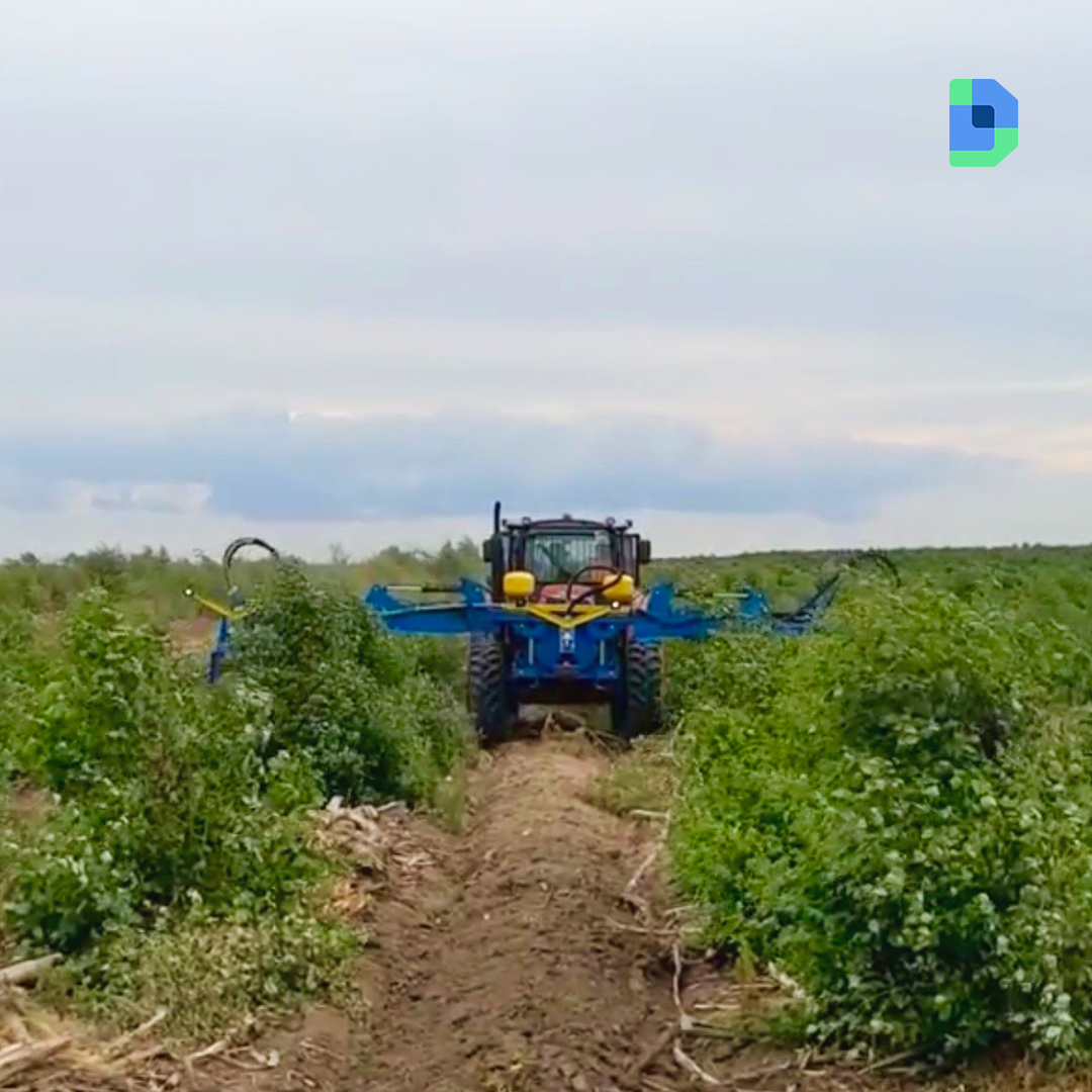
Water Balance System for Intelligent Irrigation.
In collaboration with Digital Projex, we developed a Remote Sensing-Based Irrigation Management System for the Uruguayan association "Regadores Unidos del Uruguay". This initiative aims to optimize water use in agriculture—which consumes nearly 70% of the world's freshwater—to combat scarcity and mitigate the impacts of climate change. The system's methodology is based on the widely recognized FAO-56 recommendations, utilizing the FAO Penman-Monteith model to calculate daily water balance.
- Data and Function: The system integrates daily climatological data from ground stations with Sentinel-2 satellite imagery to calculate evapotranspiration (the combined water loss from soil evaporation and plant transpiration). Crucially, it uses vegetation indexes like NDVI from Sentinel-2 to estimate the basal crop coefficient, providing more accurate, up-to-date data than static predefined tables.
- Decision Support: The platform provides current information and projects irrigation needs for the upcoming seven days. It also includes features like a soil water characterization module, an automatic reservoir estimation tool, a web-based GIS for data visualization, and a simulation component to test various irrigation strategies.
Mining and Extraction:
In industries like mining, remote sensing is great for ensuring accountability and operational safety. Applications include monitoring ground movement around infrastructure, tracking compliance with environmental permits, and verifying the success of mandatory land rehabilitation projects post-extraction. One possible use case that we've explored at Digital Sense, is the use of remote sensing data to monitor river basins and possible modifications. In this article, we show how this can be achieved with a real case.
Forestry and Carbon Management:
The integrity of the burgeoning global carbon market relies heavily on accurate, verifiable data. Remote sensing provides the only scalable method for continuously monitoring forest inventory, accurately measuring biomass, detecting illegal logging, and validating carbon sequestration efforts over vast, inaccessible areas.
At Digital Sense, we've integrated remote sensing data with “in the field” analysis to build an efficient irrigation equipment.
In a set of articles, we've also illustrated how deforestation can be analyzed using remote sensing (part 1, part 2).
Infrastructure and Utilities:
For asset-intensive industries, remote sensing provides continuous monitoring of linear infrastructure (pipelines, power lines, roads) to prevent failures and manage risk. This includes detecting vegetation encroachment, monitoring erosion along critical corridors, and identifying structural subsidence that could threaten asset integrity or cause environmental hazards.
Here’s a piece for our work on Water management solutions.
Conclusion
All in all, sustainable Remote Sensing is incredibly beneficial for all of us and our environment. For years now we’ve battling new, modern technology and sustainability. Well, this is the chance to merge those worlds. By combining advanced satellite data (SAR, LiDAR, multi-spectral imagery) with proprietary Artificial Intelligence models, this technology transforms massive volumes of global observation data into localized, actionable intelligence—from protecting critical infrastructure to verifying carbon sequestration projects.
At Digital Sense we are navigating this transformation. We specialize in developing end-to-end solutions that integrate into existing operational workflows, as demonstrated by our platforms for VRA Optimization, Geohazard Tracking, and Corridor Integrity Monitoring
We can actually make a difference and help you meet your sustainability targets while providing business value.


.jpg)